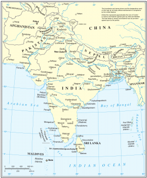
Future historians may very well remember the past year, since August 2019, as a time when South Asia’s cartographic confabulations reached a new peak, threatening to spill over on the ground as several states in the region reasserted their territorial claims.
The latest episode in a sorry saga where India, China, Pakistan, and Nepal have, all at some point, used maps to make a political point was yesterday when Indian National Security Advisor (NSA) Ajit Doval walked out of a Shanghai Cooperation Organization (SCO) meeting after his Pakistani counterpart, Moeed Yusuf, continued to display a new political map of Pakistan that includes large swathes of territory traditionally under India’s control despite Doval’s protests. Yusuf’s was a clever gambit; given that the meeting was virtual, there was no single “room” where all SCO members met, which meant each country could have whatever it chose to in their representative’s background. (No other SCO NSA displayed a map, India included.)
Pakistan unveiled a new political map of the country a day before August 5 – the one-year anniversary of India’s decision to revoke the special, autonomous status of the erstwhile Indian state of Jammu and Kashmir. The map showed the entirety of India- and Pakistan-administered Kashmir as disputed – and marked with the same color. It also, much to Indian chagrin, showed Junagadh in the Indian state of Gujarat as Pakistani territory, leading the Indian Ministry of External Affairs to term the map “an exercise in political absurdity.” (Pakistan’s Dawn, on the other hand, called the new map a “landmark move.”)
Roughly a month and a half before Pakistan’s umbrage-through-maps, on June 19, Nepal too did something quite similar: A new political map published by Kathmandu showed Lipulekh, Kalapani, and Limpiyadhura, areas India traditionally has considered its own, as part of Nepal. The move came amid serious India-Nepal tensions whose proximate cause was India’s decision to inaugurate a new road in May that connects the state of Uttarakhand to Lipulekh at the India-China-Nepal trijunction. But underlying this was growing recrimination and concerns in New Delhi about Beijing’s sway over the K.P. Sharma Oli government in Kathmandu. Finally, in November 2019, New Delhi released a new map reflecting the reorganization of Jammu and Kashmir in August of that year into two centrally controlled territories: Jammu and Kashmir as well as Ladakh. But that map, in turn, had included Kalapani as Indian territory, sparking protests by Kathmandu.
South Asians have always been very prickly about cartographic depictions of their countries; states in the region take particular umbrage (perhaps understandably so) at redrawn lines on the map even if facts on the ground remain intact.
I remember as a child how the family copy of the National Geographic – a rare luxury in the austere closed-off India of the 1980s – used to often arrive in the mail with an ugly smudged stamp on its pages that had a map of India, with an inscription stating that the territorial boundaries of the country were depicted incorrectly or something to that effect.
But it is not just India or Pakistan or Nepal. China’s nine-dash line, or for that matter its depiction of Arunachal Pradesh as part of southern Tibet, all fall into a singular pattern: where cartography is war by other, cheaper, means. It allows governments to demonstrate both to their own citizens, as well as the other state, that they mean business when it comes to sovereignty – even when there are no practical ways through which they can affect territorial claims.
Any Chinese attempt to seize Tawang in Arunachal Pradesh comes with the risk of nuclear escalation; Pakistan knows very well that the conventional military balance with India does not favor it so any plan to recover India-administered Kashmir is futile; India likewise very well knows that any military action to, say, take back Pakistan-administered Kashmir, in turn, runs the risk of a two-front India-China war. Better be revanchist or revisionist on paper that soil; better posture than the alternative.
One of things the ongoing India-China crisis in eastern Ladakh has demonstrated is how far both countries are willing to go to test each other’s will even when the border between the two remains ghost-like, neither delineated on paper nor demarcated on land. And countries in the region fear that cartographic ambiguity fuels eventual military aggression. After all, it was the vagueness of language in the 1949 Karachi agreement about the Line of Actual Control — then called the Cease-Fire Line, after the first war between India and Pakistan in 1947 — in the treacherous Siachen area in (what is now considered) western Ladakh that paved the way for both countries’ plans to grab it, with India succeeding in April 1984. That, in turn, provoked Pakistan to embark on Operation Koh-e-Paima leading to the 1999 Kargil war with India.
One of the most striking things about the maps of South Asia in the last 76 years is how fluid the subcontinent has looked over time. Between the reorganization of the region after India’s independence and the creation of Pakistan in 1947 to the aftermath of the 1971 war when the eastern wing of Pakistan, now Bangladesh, was suddenly marked with an different color than its western part, static maps have been far from the norm. And then there are those “smaller” changes too, for example Goa being forced to become a part of India — rather than remain a Portuguese colony — in 1961, or Sikkim being absorbed into the Indian republic in 1975. Then of course, there is the saga of how five princely states who had initially chosen to remain independent of India, such as Junagadh – whose incorporation in Pakistan’s new political map in August this year irked India so much – came to be part of the country.
As long as history shapes peripheral visions in the region, the map and the territory will continue to be seen as the same.


