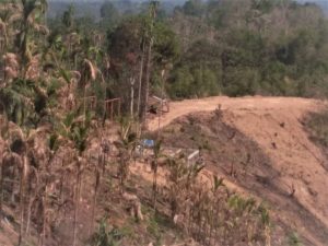
As many as seven people, including six police personnel and a civilian, were killed and scores of others injured when police forces of the two neighboring states of Assam and Mizoram in India’s Northeast exchanged fire over a border dispute.
The incident, which happened on July 26 in the border area of Lailapur (Assam)-Vairengte (Mizoram) districts, saw the two sides using bullets, tear gas canisters, and grenades against each other. At its roots lies a border dispute that goes back over 150 years.
Predictably, both the Assam and Mizoram state governments pinned the blame on the other side for the recent violent eruption of the conflict.
Assam Chief Minister Himanta Biswa Sarma accused the Mizoram police of using Light Machine Guns (LMGs) and being hand-in-glove with miscreants. Sarma told reporters that forests were being cleared for the construction of roads and cultivation at Lailapur bordering Mizoram. Mizoram chief minister Zoramthanga claimed that it was Assam police that had entered his state and committed arson.
The Assam police have registered cases against a Mizoram member of parliament for issuing threats, and six police officials who were allegedly involved in the firing incident on July 26. In retaliation, Mizoram police have filed complaints against Sarma and four Assam police officers on a string of charges, including attempted murder.
Both chief ministers took the battle to Twitter, where they blamed each other for the clash. Incidentally, the exchange of fire happened only two days after Home Minister Amit Shah delivered a speech in the neighboring state of Meghalaya calling for a peaceful resolution of inter-state border disputes.
India’s Northeast comprises of eight states which are often referred to as the “Seven Sisters and Sikkim,” Sikkim being a more recent addition to the category.
Four of these eight states, including Mizoram, which was called Lushai Hills during the colonial era, were carved out of Assam. Mizoram was granted Union Territory status in 1972 and statehood in 1987.
Assam and Mizoram share a 165-kilometer-long border and two stretches at Lailapur-Vairengte and Karimganj-Mamit districts are disputed.
The dispute can be traced back to the colonial period when two border notifications were issued. In 1875, a notification drew a line between the Lushai Hills and Cachar plains (currently in Assam) and another in 1933 demarcated a boundary between the Lushai Hills and Manipur.
Mizoram is of the view that the boundary should be fixed on the basis of the 1875 notification, while Assam is of the opinion that it is the 1933 order that ought to be the basis for determining the border.
Clashes between Assam and Mizoram have erupted occasionally, with the first dating back to 1994. In October of last year, the conflict escalated and there were reports of violence from some areas along the border. Early last month, Assam Police alleged that a mob from Mizoram triggered bomb blasts after making an attempt to encroach land.
Border disputes are not uncommon among the states in India’s Northeast. Mizoram has a border row with Tripura as well, while Manipur has claimed the Dzukou Valley, which is currently in Nagaland.
The majority of the border disputes in the frontier region involve Assam, owing to its central location. The state has disputes with Mizoram, Meghalaya, Nagaland, and Arunachal Pradesh, which have flared-up occasionally over the past several decades.
Following the recent clash, Assam has decided to approach the Supreme Court for protection of the Innerline Forest Reserve in Cachar district from destruction and encroachment by Mizoram. Assam has previously petitioned the apex court for demarcation of the border with Nagaland and Arunachal Pradesh but it failed to produce an outcome.
The crisis has prompted the Ministry of Home Affairs to go on into overdrive to defuse the tension between the two states in the Northeast.
India’s Bharatiya Janata Party (BJP) government does not want the conflict to drag on, since Assam is ruled by the BJP and Mizoram by the Mizo National Front, which is part of the North East Democratic Alliance (NEDA), a coalition of non-Congress political parties in the region. It does not want the NEDA to come apart.
The government has decided to deploy central paramilitary forces in the disputed areas following a flurry of meetings in New Delhi, involving top officials from Assam and Mizoram. In addition, the government has decided to make use of satellite imaging to demarcate the inter-state boundaries. Senior government officials told the media that the Meghalaya-based North Eastern Space Application Centre (NESAC) has been given the task of demarcating boundaries of the states in the region.
Almost a week after the incident, the stand-off between Assam and Mizoram seems to have subsided with both the chief ministers tweeting that they would adopt a cordial approach to the row.
The situation on the border continues to be tense but under control since central paramilitary troops began patrolling the highway between the two states. An organized blockade on Assam’s roads leading to Mizoram has ended but trucks carrying goods are still reluctant to embark upon the journey.
Miozram is landlocked and without a rail link to neighboring states. Goods are being supplied via the neighboring state of Tripura and a cargo flight delivered more than 3,000 kilograms of commodities a few days ago.


