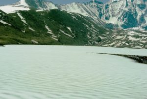
Recurring floods in the Himalayan region have prompted the Indian government to initiate a slew of measures to tackle disasters from glacial lake outbursts.
In reply to a Parliamentary Standing Committee on Water Resources query, the Narendra Modi government has listed steps it has initiated to deal with glacial lake outburst floods (GLOF) in the country. Glacial lakes have triggered floods occasionally in the region with the deluge in Pakistan being the most recent example.
The Ministry of Jal Shakti (Water Resources) disclosed before the committee that the Central Water Commission (CWC) has 46 existing meteorological observation stations in the Himalayan region, 1,000 meters above mean sea level out of which 35 stations are telemetry-based stations. As many as 16 new telemetry-based meteorological observation stations have been proposed in the Himalayan region, which are under various stages of implementation.
The ministry pointed out that the Defense Geo-informatics Research Establishment (DGRE) has been working to enhance the number of Automatic Weather Stations for forecasting avalanches and landslides in a phased manner to increase the coverage area in the states of Himachal Pradesh, Uttarakhand, Sikkim, Arunachal Pradesh and in the union territories of Jammu & Kashmir, and Ladakh. It has already established three Mountain Meteorological Centers in Ladakh, Jammu and Kashmir and Uttarakhand for avalanche study.
Further, DGRE has joined hands with the Swiss Federal Institute for Snow and Avalanche Research (SFISAR) to develop a model for forecasting. A network of 35 Automatic Weather Stations is to be built soon in the border state of Sikkim to generate avalanche forecast data for the armed forces.
All these facilities, informed the ministry, are in addition to the five meteorological and discharge stations in the high-altitude regions located 3,800 meters above sea level that operates under the Wadia Institute of Himalayan Geology (WIHG).
There are other government agencies to monitor, predict and undertake research on GLOF, landslide lake outburst flood (LLOF), cloudburst flood, and so on, such as the Geological Survey of India, Department of Science and Technology, Defense Research and Development Organization and the ministries of Environment, Forests and Climate Change and Earth Sciences.
Scientists and environmentalists believe that the frequency of glacial lake outburst floods (GLOF) could increase due to climate change. New lakes are formed as the temperature rises, existing ones expand and sometimes they merge, enhancing the possibility of flood volumes in the high mountains.
Several Indian states are considered vulnerable as there are 9,575 glaciers in the Himalayan region contiguous to the country.
According to an estimate, over 200 of these are susceptible to outbursts. Research by a group of scientists last year found that the highest GLOF risk currently is in the eastern Himalayan region where the risk level is at least twice that in adjacent regions. The scientists were of the view that the possibility of hazards in the future in this zone would “almost triple” due to more lake formations.
In the Indian Himalayan region, the first GLOF was reported in 1926 in Jammu and Kashmir. In the 1980s, scientists observed two instances of sudden emptying of moraine-dammed lakes in Himachal Pradesh. In 2013, Uttarakhand faced an unprecedented flood after the Chorabari glacier melted, leaving a death toll of more than 5,000 people.
The Parliamentary Standing Committee, which was headed by Dr. Sanjay Jaiswal, expressed concern over the impact of climate change on glacier movement in the Indian Himalayan region. “Recognizing and spotting dangerous glacial lakes is very important so that all the stakeholders i.e. planners, scientists, academics, and the general public may evolve, adopt and carry out suitable mitigation steps such as monitoring, early warning, evacuation, and relief and rehabilitation,” said the report. The committee has submitted this report to Parliament.
It has also recommended that the ministry should make “concerted efforts” to set up and widen the network of high-altitude meteorological and discharge stations equipped with modern technology including Synthetic Aperture Radar imagery to automatically detect changes in water bodies and lake formations in the Indian Himalayan region. It has told the ministry to work in “close collaboration” with other agencies involved in glacial management and analyzing the mountain hazards by sharing data with them which the ministry has agreed.


